How to use OFDS data
0.3.0 release
Welcome to the Open Fibre Data Standard 0.3.0 release.
We want to hear your feedback on the standard and its documentation. For general feedback, questions and suggestions, you can comment on an existing discussion or start a new one. For bug reports or feedback on specific elements of the data model and documentation, you can comment on the issues in the issue tracker or you can create a new issue.
To comment on or create discussions and issues, you need to sign up for a free GitHub account. If you prefer to provide feedback privately, you can email info@opentelecomdata.net.
This page provides examples that demonstrate how to use OFDS data in common tools and how-to guides for specific topics.
Examples
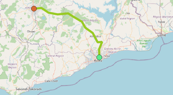
QGIS
The example QGIS file shows how to use QGIS to visualise the example OFDS GeoJSON data.
To explore the example file:
Clone the OFDS GitHub repository.
Open
examples/qgis/geojson.qgsin QGIS.Explore the attribute table for the nodes and spans layers and use the schema reference to look up the meaning of each attribute.
Alternatively, you can download the example QGIS file and the example nodes.geojson and spans.geojson files separately. However, when you open the example QGIS file you will need to use the Handle Unavailable Layers dialog to locate the nodes and spans files.
To recreate the example file:
Load the
.geojsonfiles as vector data sources with theFLATTEN_NESTED_ATTRIBUTESoption enabled. For more information on the options for loading GeoJSON data, see the GDAL GeoJSON driver documentation.In the symbology properties for each layer, choose the categorized renderer with the following classification values:
spans:
darkFibrenodes:
accessPoint
Add a vector tile layer using the OpenStreetMap XYZ Tile service.
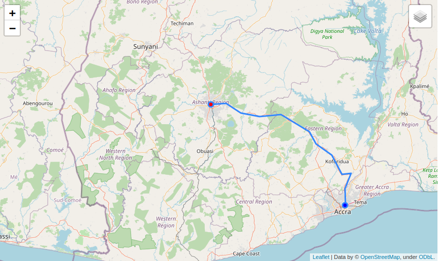
Leaflet
The example Leaflet notebook shows how to use Python, Folium and Leaflet to visualise the example OFDS GeoJSON data on a map. You can download the notebook as an .ipynb file or view it in your browser.
How to guides
How to plot coordinates accurately
Coordinates in OFDS data are specified in the urn:ogc:def:crs:OGC::CRS84 coordinate reference system (CRS). To create accurate maps, you need need to set the correct coordinate reference system when using OFDS data.
If you are using OFDS data published in GeoJSON format, then the tool that you are using is likely to default to the correct CRS because urn:ogc:def:crs:OGC::CRS84 is the default CRS for GeoJSON data.
If you are using OFDS data published in other formats, then you need to pay careful attention to coordinate ordering. urn:ogc:def:crs:OGC::CRS84 is equivalent to EPSG:4326 with reversed axes so, if it is not supported by the tool that you are using, you can set your CRS to EPSG:4326 and ensure that you read coordinates in longitude, latitude order.
For more information on transforming coordinates from one CRS to another, see how to transform coordinates to the correct coordinate reference system.